Divergent Directions
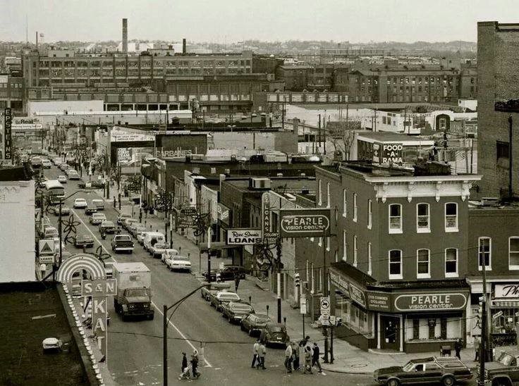
Then and Now in Upton and Highlandtown
Sources
- Hillier, Amy E. (2003). “Redlining and the Home Owners’ Loan Corporation”. Journal of Urban History. 29 (4): 394–420.
- “The Culture and History of Upton.” Upton Planning Committee. https://historicupton.com/culture-and-history/
- Mapping Inequality: Redlining in New Deal America. https://dsl.richmond.edu/panorama/redlining/#loc=11/39.296/-76.715&city=baltimore-md
- Upton, Baltimore. (n.d.) World Heritage Encyclopedia. http://self.gutenberg.org/articles/Upton,_Baltimore?View=embedded
- Samuels, Barbara. (2008). “Baltimore 68: Riots and Rebirth.” ACLU of Maryland.
- Upton Urban Renewal Environmental Impact Statement. (1975). Department of Housing and Urban Development. https://books.google.com/books?id=xOA3AQAAMAAJ&lpg=SA1-PA22&dq=1970s%20urban%20renewal%20upton&pg=PP1#v=onepage&q=1970s%20urban%20renewal%20upton&f=false
- “Royal Theatre Marquee Monument.” Baltimore National Heritage Area. https://www.explorebaltimore.org/places/royal-theater-marquee-monument
- “Avenue Market.” Explore Baltimore Heritage. https://explore.baltimoreheritage.org/items/show/410
- Valdez, Jessica. (2003). “Troubled West Baltimore site gets fresh start with Heritage Crossing.” The Baltimore Sun. https://www.baltimoresun.com/news/bs-xpm-2003-07-16-0307160102-story.html
- Cassie, Ron. (n.d.) “City of Immigrants.” Baltimore Magazine. https://www.baltimoremagazine.com/section/historypolitics/city-of-immigrants-the-people-who-built-baltimore/
- “Patterson Park/Highlandtown Historic District.” National Register of Historic Places. https://mht.maryland.gov/secure/medusa/PDF/NR_PDFs/NR-1310.pdf
- Newby, Tim (2015). Bluegrass in Baltimore: The Hard Drivin’ Sound and Its Legacy. Jefferson, North Carolina: McFarland & Company, Inc. p. 19.
- “Scenes from the 70s: The East Baltimore Documentary Photography Project.” Maryland Center for History and Culture. https://www.mdhistory.org/scenes-from-the-70s-the-east-baltimore-documentary-photography-project/
- Crockett, Sandra. (1998). “Highlandtown is Grand.” The Baltimore Sun. https://search.proquest.com/docview/406381833/3EECC2A666E24DFEPQ/4?accountid=10750
- Meehan, Sarah. (2012). “New migration: Latinos move farther east to open Baltimore businesses”. Baltimore Business Journal. https://www.bizjournals.com/baltimore/print-edition/2012/11/16/new-migration-latinos-move-farther.html?page=all
In the 1930s, the federally-sponsored Home Owners’ Loan Corporation created its infamous “residential security maps” to indicate the risk of real-estate investments in neighborhoods across 239 American cities. Areas were designated as “best, still desirable, declining, or hazardous,” indicated by rankings of A, B, C, or D, respectively.
Higher rankings were typically given to newer, wealthy, and white neighborhoods, while lower rankings were given to older, poor, and black neighborhoods. These maps were used by both public and private lenders as a means to deny loans from those living in low-ranking neighborhoods, known today as “redlining”. [1]


The Baltimore neighborhoods of Upton and Highlandtown both received residential security rankings of “D” from the HOLC. At the time, Upton was one of the most affluent black neighborhoods in the country. Despite being a center of African American culture and wealth with the nickname “Baltimore’s Harlem” [2], the neighborhood was viewed as dangerous by the government due to its majority black population [3]. Meanwhile, Highlandtown was historically a blue-collar neighborhood, considered risky at the time for its large population of working-class European immigrants [3]. Despite having received the same ranking, the two neighborhoods were very different landscapes.
Nearly a century later, Upton is now one of the poorest, most disinvested neighborhoods in Baltimore while Highlandtown is booming with economic growth and prosperity.
Despite Upton’s growing black middle-class in the first half of the 20th century, neighborhoods to the south and west were historically home to working-class African Americans. [4] The north-adjacent neighborhood of Bolton Hill was white but “declining” according to the HOLC. In an effort to preserve the area, the first “negro” public housing project in Baltimore, McCulloh Homes, was established in Upton in the 1940s.
“…a splendid barrier against the encroachment of colored into an adjacent good white residential neighborhood.”
A similar project, Poe Homes, was constructed shortly after in the south-adjacent neighborhood of Poppleton. [5].
By the mid 20th century, Upton’s population had grown significantly as the restrictions of racial segregation limited black residents to certain neighborhoods. With the influx of less affluent African Americans, the dynamics of the culturally rich, once wealthy neighborhood began to change, and many middle-class black families opted to move away from the city center as a part of suburbanization. [4]
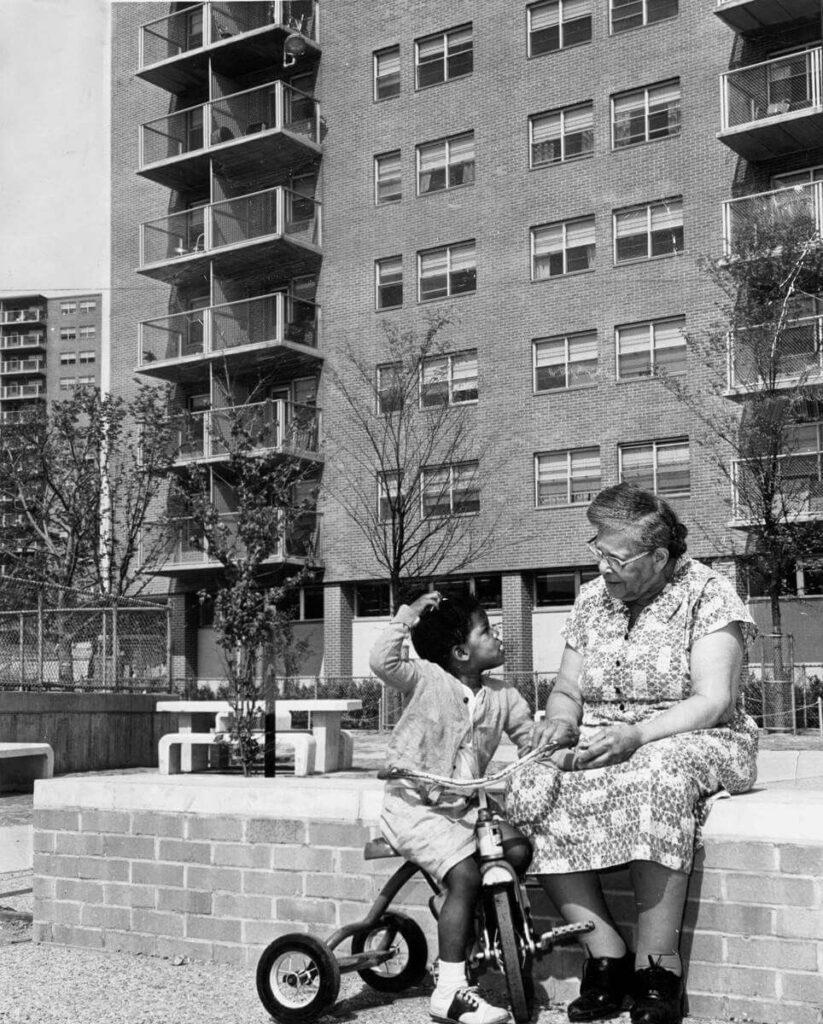
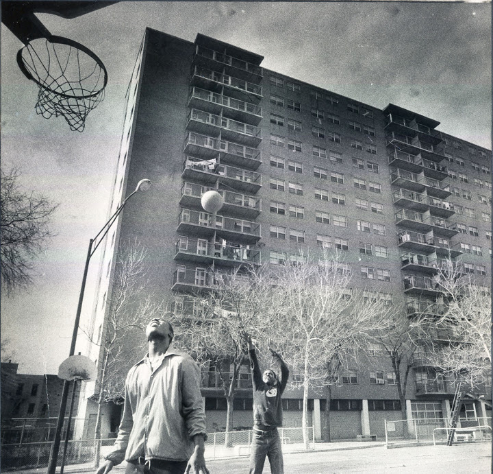
The 1950s marked the end of legal racial segregation in Baltimore. Coincidentally, Upton’s Murphy Homes project was opened in 1959, shortly followed by the nearby Lexington Terrace project in Poppleton in 1963. Both public housing complexes were built as high-rise, high-density apartments.
While neighborhoods were no longer legally segregated, the placement of these compact projects in the historically black area of Upton strategically avoided the construction of more spread out public housing on vacant land in the neighboring white areas. [5]
As the exodus of wealthy families to the suburbs continued through the 1970s, the city entered into a period of economic decline that hit West Baltimore especially hard. In response, controversial urban renewal projects were responsible for the replacement of much of the historical architecture in Upton. [6] This included the demolition of the Royal Theatre, the famous black-owned venue located on Pennsylvania Avenue where all of the major jazz and blues stars of the 20th century had performed. [7]
Economic decline and disinvestment in West Baltimore continued through the 1980s, increasing the demand for affordable housing. The first high-rise extension of the McCulloh project was constructed in Upton, and the Julian Gardens project was built a few blocks east of Murphy near Harlem Park. [5] Efforts to bring business and appeal to Upton included the renovation and reopening of the historic Lafayette Market as the new Avenue Market in the 1990s. [8] The venue, designed to be an economic hub for local black entrepreneurs, remains open today but has struggled to retain businesses over the years. Despite the low cost of living and revitalization efforts in the neighborhood, the population in Upton dropped significantly around the turn of the century.


Revitalization efforts continued into the early 2000s with the demolition of the Murphy Homes project and the opening of Heritage Crossing, a mixed income townhouse community bordering MLK Boulevard. [9] It’s opening on the land where Murphy Homes once stood signified the only major development in Upton for over 2 decades. Despite these efforts, many row homes in Upton remain vacant or abandoned today.
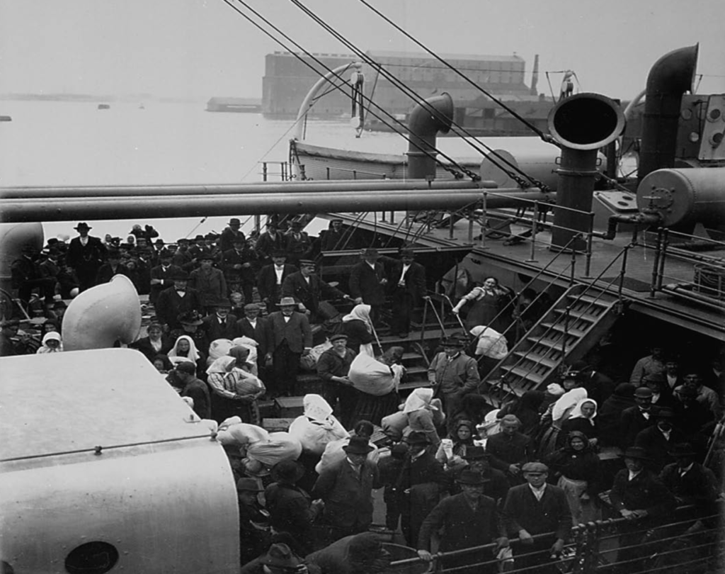
By the beginning of the 20th century, over 2 million European immigrants had arrived through Baltimore’s ports, earning it the nickname “the other Ellis Island.”
Many of these migrants settled in East Baltimore, resulting in a patchwork of tightly-knit ethnic communities in Highlandtown by the 1940s. [10] Known to this day for its row houses with pristine white marble steps, the neighborhood was home to many workers employed at the nearby industrial area. [11] This attracted economic migrants from across the country, especially Appalachia. [12] To house the influx of factory workers during World War II, the “white” public housing project O’Donnell Heights was opened in the nearby neighborhood of Greektown. [5] This would be the only project ever opened in the greater East Baltimore area.
Highlandtown experienced both cultural and economic prosperity up until the 1970s as the manufacturing industry began to decline. Many of the historical family-owned department stores in the commercial district closed under financial pressure and reopened as franchised shopping malls. [11] The decrease in employment opportunities and the appeal of the suburbs drew many long-time residents of Highlandtown away. As newcomers began to move in, neighborhood dynamics began shifting away from the strong cultural communities that once existed. [13] Despite these changes, the neighborhood remained almost 100% white.
Despite Baltimore’s continuous economic and population decline, the situation in Highlandtown had turned around by the turn of the century. [14] With the influx of restaurants and businesses, the once blue-collar neighborhood transformed into a much desired place to live. Today, Highlandtown is one of the most expensive neighborhoods in Baltimore to live in. Additionally, Highlandtown’s racial demographics have drastically changed over the last few decades as black and hispanic populations have increased. Today, it has one of the highest hispanic populations of any other neighborhood in the city. [15]
Investment and divestment have a huge role in shaping cities. Despite the fact that both neighborhoods were considered undesirable decades ago, Upton and Highlandtown have diverged into two completely different economic landscapes. Upton has been used to strategically concentrate poor black populations, resulting in the area being continuously divested from over time. On the other hand, Highlandtown has become one of the most prosperous areas in the city as a result of investment. In order to achieve more socially equitable cities, neighborhoods cannot diverge in such drastic ways as Upton and Highlandtown have.